There's this point on a ride like that where you're low on food and water and your unsure what lies ahead. A part of you wants to play it conservative, turn around, and cut your loses, but you keep going. This was one of those rides.
It's an awesome, hard ride, with about 5,000 feet of climbing and 40 miles. It feels similar to Sheep Mountain in that it's committing, strenuous and you feel like you're riding through the middle of nowhere, but unlike Sheep it's mostly on logging roads. Of course, I forgot my GPS this ride, but the Thursday night MTB ride has one posted on the web here.
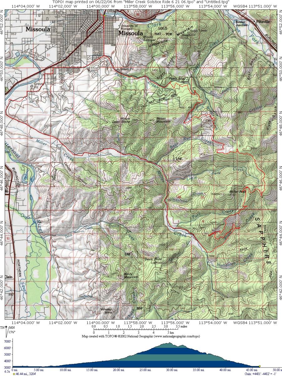
Below is the route beta (it's actually not that complicated).
Warning: this description is vague and comes with no guarantees. Also, it is extremely easy to get lost on the middle sections of this ride, so be very careful if you try it and take a friend.
- from upper-Pattee trailhead, ride south up the left-hand, wide trail/road, staying left, until near the top where you'll follow the single track on the right, taking you up and over the ridge onto upper Deer Creek Road;
- follow the road up to a saddle, where you'll see Miller Peak to the south, with radio towers, and views to the west;
- continue on the main fork, left, climbing gently for several miles (3-4?), until you come to the next east-west ridge to the north of Miller Peak;
- on the ridge you'll come to a fork in the road, with the right fork heading down, stay left, then soon right, climbing, then right again to a dead end turnaround, where you'll follow faint single track briefly to an old jeep road;
- climb steeply on the jeep road up the ridge until it intersects a logging road, where you'll turn right, heading south until you come to a road junction, or, as was the case for me, you see the road junction 100 yards below and have to down hike to it;
- at the road junction you'll see the single track on the far (south) side, get on this trail (look for intermittent flagging) and stay on it for several miles, crossing several roads, until you reach the ridge containing Miller Peak;
- the single track ends at a dirt jeep road on the ridge, with Miller Peak on your right, but you are a bit too far from Miller Peak to start the descent, so turn sharp right, climbing up 100 yards to the ridge top, then follow the road left, traversing to the Miller Peak road/saddle;
- and finally, turn left at the road junction (straight takes you to the top of Miller Peak) and follow this winding road all the way down to Miller Creek.
PS: On a whim, I raced Missoula XC the day after I did this. Not a good idea. I got spanked and was wasted for a day after. Someone please remind me that I'm 40.

No comments:
Post a Comment